Back لومونوسوف Arabic Lomonosov (şəhər) Azerbaijani لومونوسوو AZB Ломоносов (ҡала) Bashkir Ламаносаў (горад) Byelorussian Ламаносаў (горад) BE-X-OLD Ломоносов (гӀала) CE Lomonosov CEB Lomonosov (şeer) CRH Lomonosov (město) Czech
| Stod
Lomonossow
Ломоносов
| ||||||||||||||||||||||||||||||||||
| ||||||||||||||||||||||||||||||||||
| ||||||||||||||||||||||||||||||||||
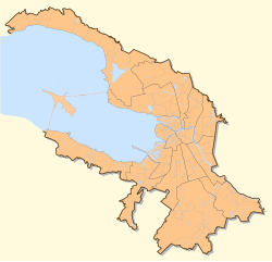
Lomonossow (russ. Ломоносов), bis 1948 Oranienbaum, is a Stod, de wos administrativ zu Sankt Petersburg (Russland) ghead. Sie liegt 40 km westli vom Stodzentrum aun da Newabucht vo da Ostsee und sidli vo da Insl Kotlin im Rajon Petrodworez. Im Woppm fiaht de Stod an Orangenbaam.
Oranienbaum hod 1780 s Stodrecht kriagt. Bis 1998 woas a söbständige Stod, is daun owa unta de städtische Vawoitung vo St. Petersburg gstöd wuan. 1992 hod Lomonossow 42.000 Eihwohna ghobt. 2010 woans 42.505 Eihwohna.
Des Ensemble aus Schlessan, Pavillons, an Schlosspark und vo da historischen Oidstod is 1990 vo da UNESCO in d Listn vom UNESCO-Wödeabe aufgnumma wuan.
- ↑ Itogi Vserossijskoj perepisi naselenija 2010 goda. Tom 1. Čislennostʹ i razmeščenie naselenija (Ergebnisse der allrussischen Volkszählung 2010. Band 1. Anzahl und Verteilung der Bevölkerung). Tabellen 5, S. 12–209; 11, S. 312–979 (Download von der Website des Föderalen Dienstes für staatliche Statistik der Russischen Föderation)
© MMXXIII Rich X Search. We shall prevail. All rights reserved. Rich X Search


